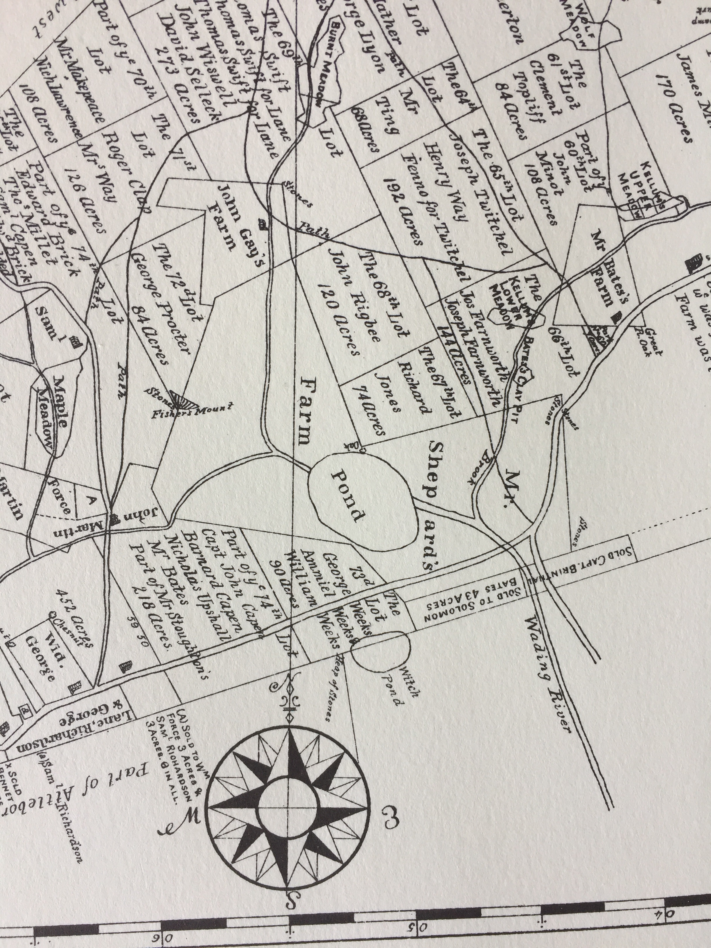
Shown here is a small section of a larger map that was drawn in 1730.
"Pond" on Mr. Shephard's Farm is within what will become Lake Mirimichi.
The road between Shepard's Pond and Witch Pond is now Route 106. On the right, when the road forks, the upper branch is South Street in Foxboro.
Your comments are welcomed. |
 Click on map for a larger view. Click on map for a larger view.
On lower border each white or black bar is a quarter mile. |
|
|
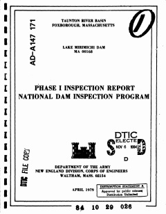
1979 Inspection report
of Lake Mirimichi dam |
Early history gathered from the Foxboro Reporter:
In 1925 the city of Attleboro appropriated the initial $55,000 as the first step in securing a newer and greater water supply for the city by building two new dams to create Mirimichi Pond, Foxboro, a reservoir destined to hold more than 350,000,000 gallons of water. The level of the water was to be raised five feet above the level of the previous several years.
In 1926 several camps and a dozen cottages and buildings in South Foxboro were moved back from the shore of the lake and the shores were cleared of brush and trees.
In February 1927 construction of the new dam was finished. There still was difficulty in securing one piece of real estate in Mansfield desired for the carrying out of the plan. |
|
|
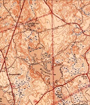
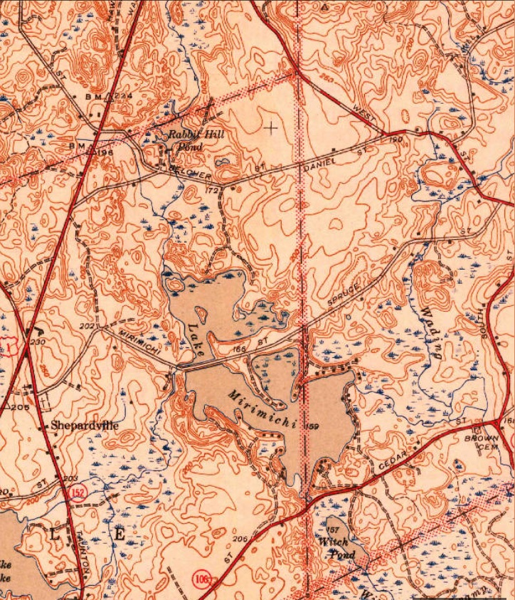
1940 topographic map of
area.
Note: One house on Treasure Island
but no houses on Mirimichi St.
Click map for larger view. |
|
Fun facts from a presentation by Jack Authelet:
Mirimichi in the native’s tongue means laughing waters because it is primarily spring fed.
Originally, the rights to the water in Lake Mirimichi were own by a mill in Dodgeville. Later they were purchased by the city of Attleboro.
Some water comes from Turnpike Lake and enters Lake Mirimichi near the Mirimichi Street bridge.
A major flow of water in the area comes from the base of the mountains in New Hampshire. |
|
|
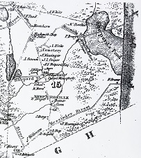
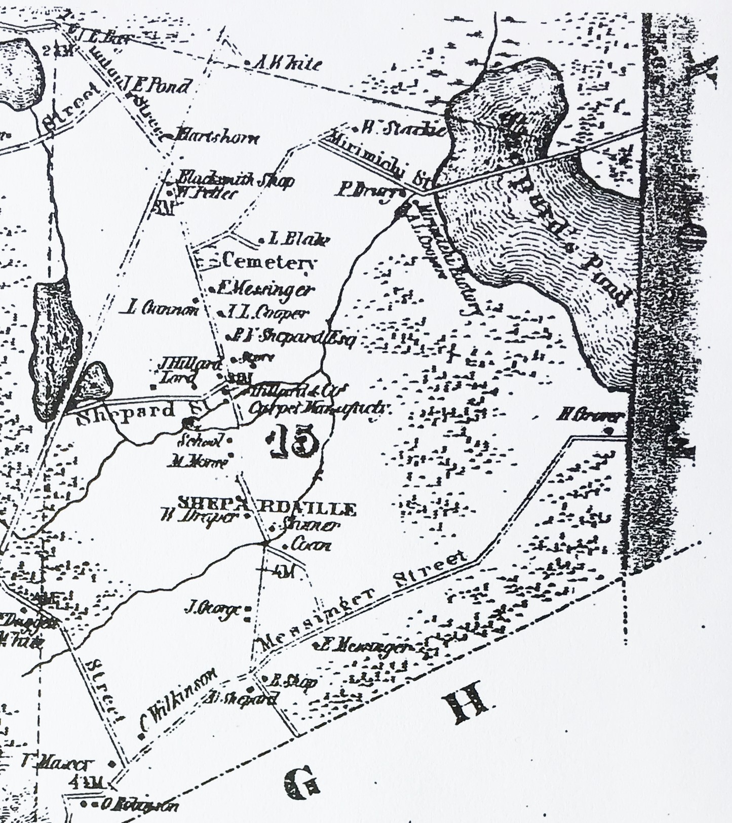
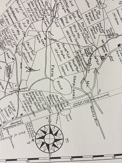
1851 map showing road across Pond.
Foxborough is east and south of
what is still called Wrentham.
Click map for larger view. |
Mirimichi Poultry Farm
Do you know there was a farm called Mirimichi Poultry Farm
on the shore of our lake?
"W.H.Saart's great poultry ranch in the heart of the forest and on the shores of Lake Mirimichi where natural beauty abounds
and poultry of finest quality is bred."
"Few people in town ever saw this farm as it is not on
a town
highway and is located at the extreme edge
of the town
at the Plainville line."
|
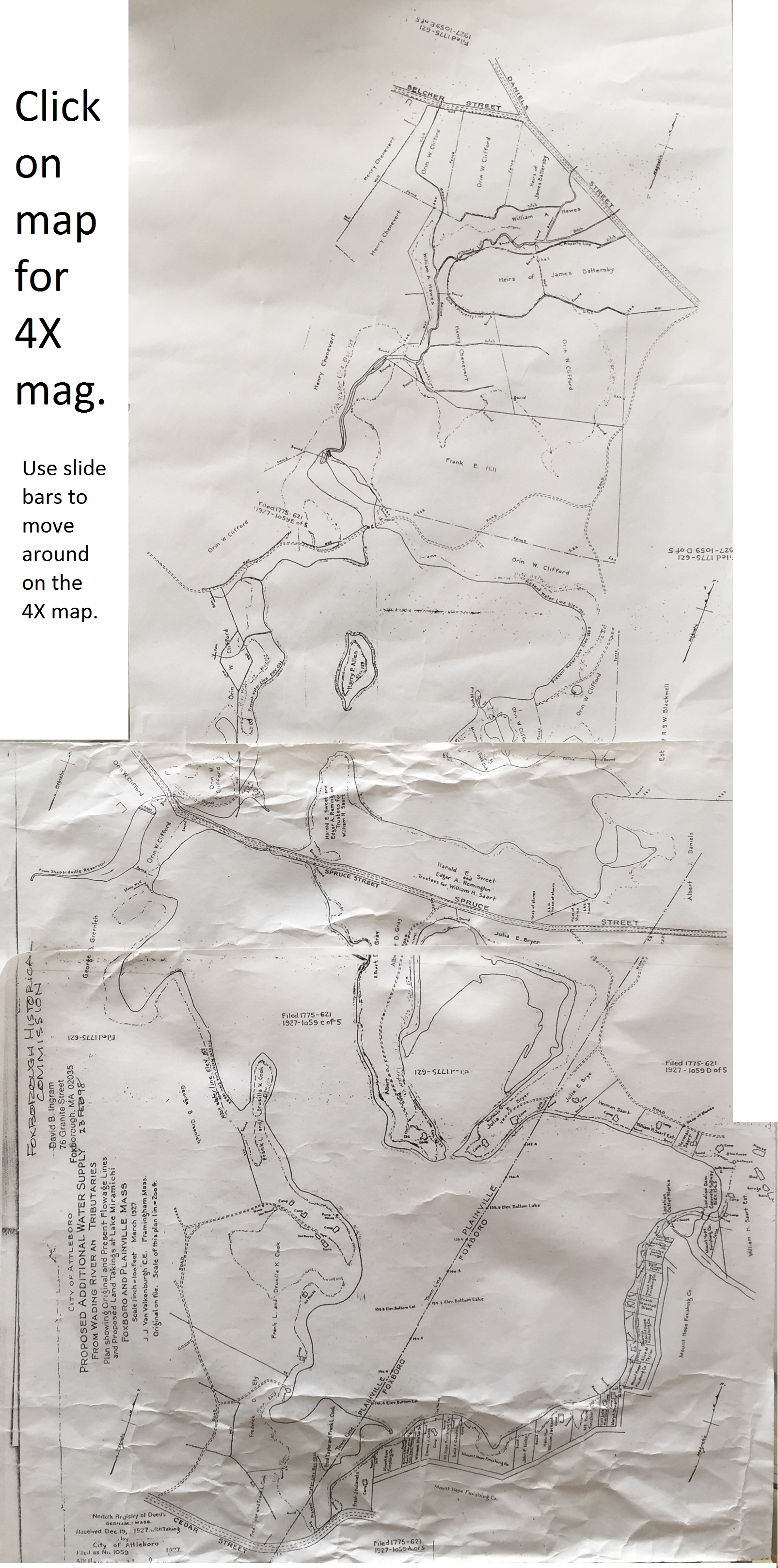
A 1927 map of the land around the lake shows that W.H. Saart
owned a considerable amount of land at the east end of the lake.
Therefore, we can assume that his poultry farm was at least partly on the land that is currently the Independent Sportsman's Club.
To view enlarged view of east end of 1927 lake map, click here. |
Check out the first few pages of their catalog
or read a 1919 article and ads from Everybodys Poultry Magazine.
or read a 1915 article and ads from Poultry Success.
|
|
1927 map
Click on map for larger view. |
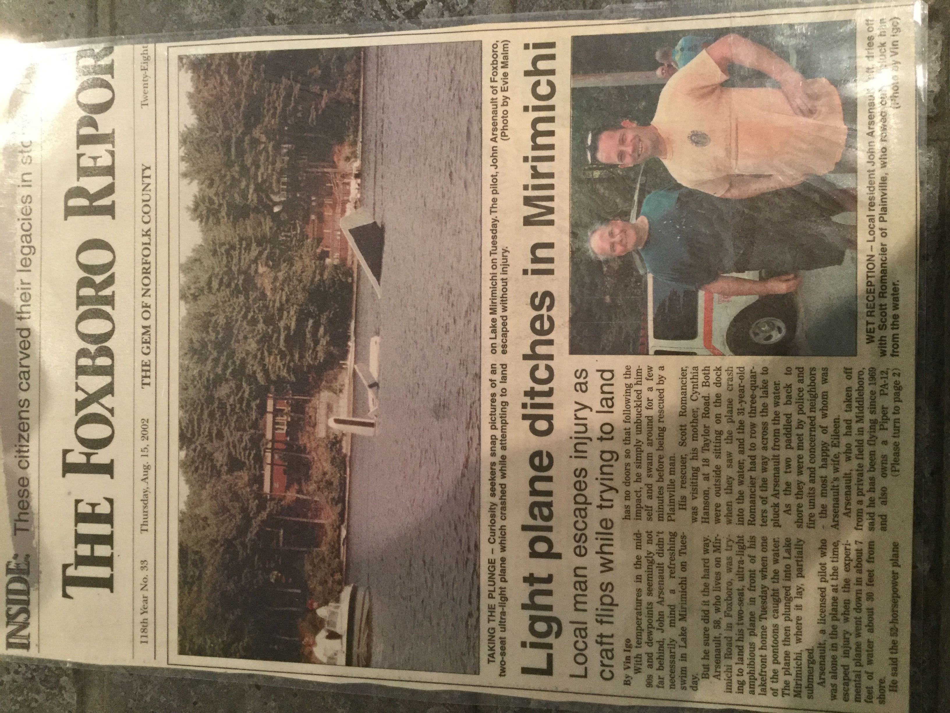
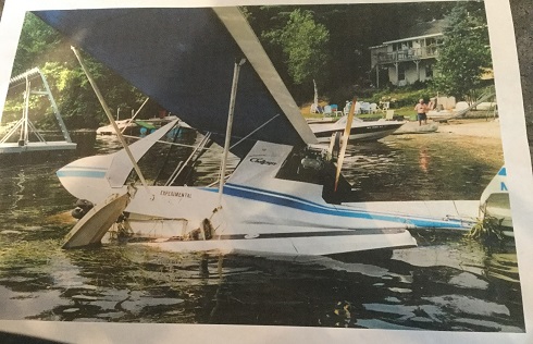
August 15, 2002 plane crash on Lake Mirimichi
Click on photo to see Foxboro Reporter article |
 |
|
|
Please email us about any information you may have relating to the history of Lake Mirimichi.
Lakemirimichi@gmail.com |


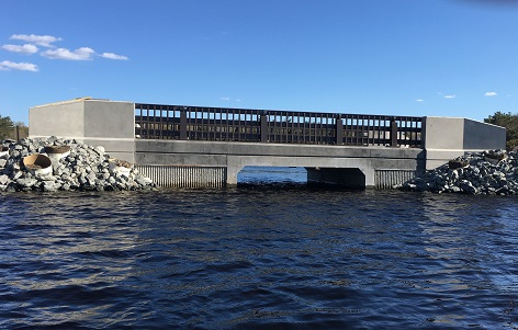
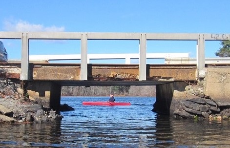 The Old Bridge, Nov 7, 2015